
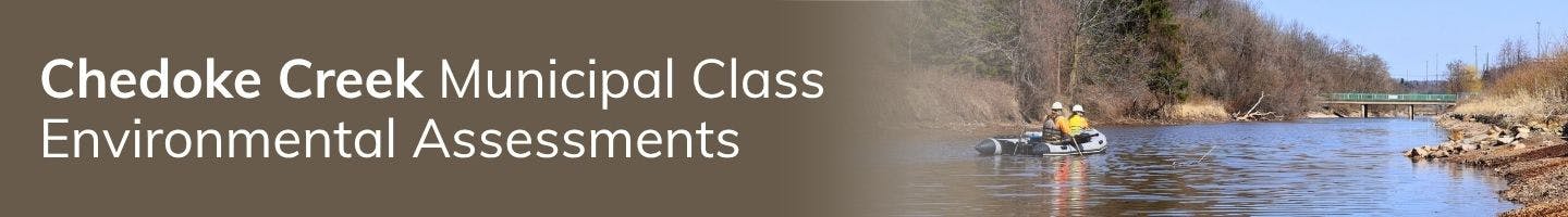
Chedoke Creek Watershed
The Chedoke Creek watershed is approximately 25 km squared and is highly urbanized, spanning the western limits of the City of Hamilton including areas south and north of the Niagara Escarpment and ultimately discharging to Cootes Paradise, Hamilton Harbour and then Lake Ontario.
Past Challenges, Present Concerns, and Future Opportunities
There have been numerous studies related to the Chedoke Creek watershed over the past few decades, ranging from environmental reviews to infrastructure capacity assessments. Water quality concerns have been identified in the Chedoke Creek, particularly as it relates to impacts to Cootes Paradise.
Following the 2014-2018 discharge event from the Main King CSO tank, water quality concerns of the Chedoke Creek have been justifiably raised by the broader community.
The City has been working closely with the Ministry of the Environment, Conservation & Parks (MECP) to respond to the various Orders issued by MECP related to the spill, including the completion of targeted dredging of Chedoke Creek, along with the investigation and implementation of offsetting measures in Cootes Paradise.
Hydrology and Creek Segmentation: How the Creek Flows
Chedoke Creek collects stormwater runoff from the western part of the Hamilton Mountain. The water then passes over the Niagara Escarpment and flows through closed pipe and open creek channels before discharging into Cootes Paradise, at Princess Point.
The Chedoke Creek can be divided into three branches;
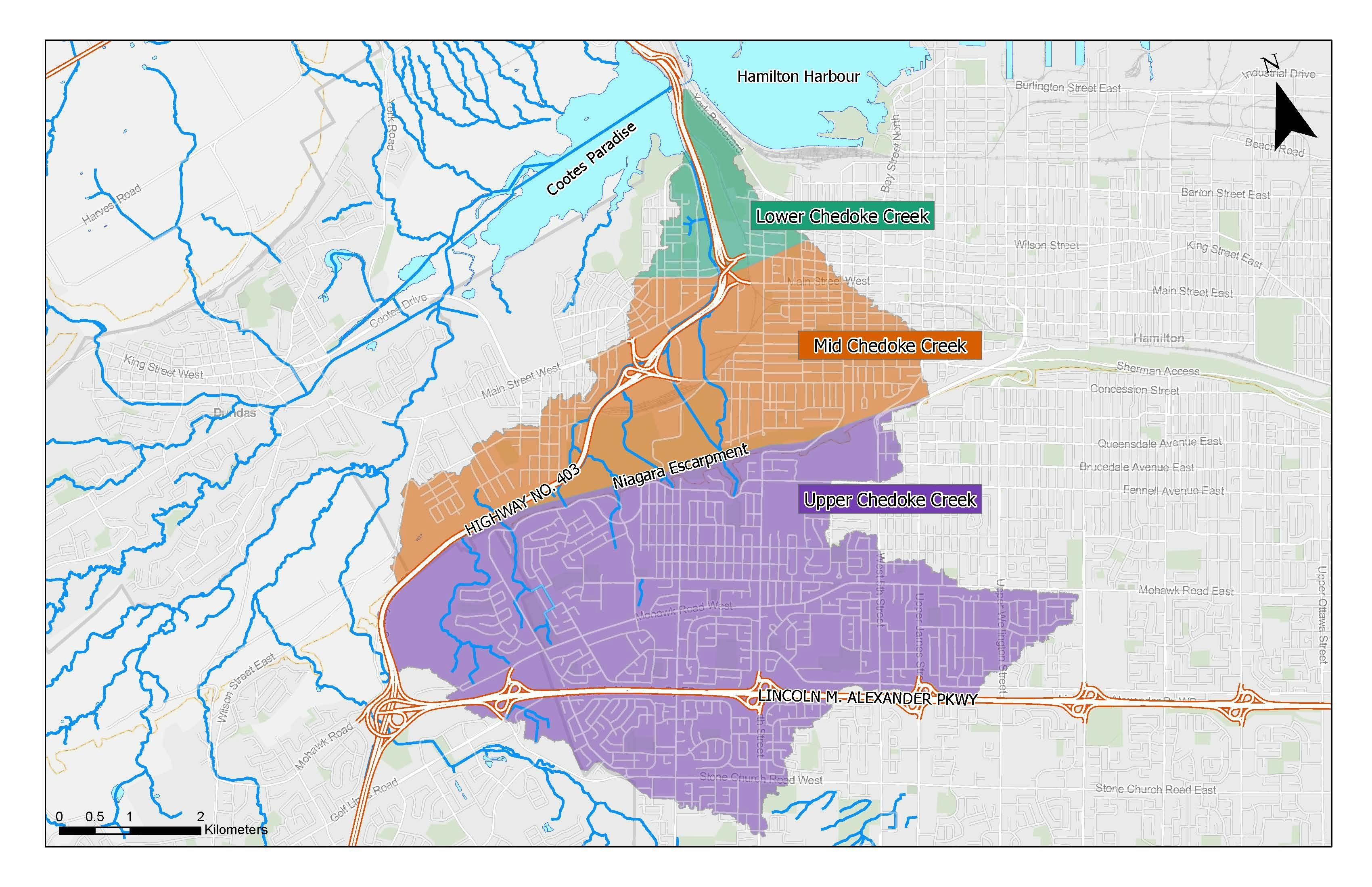
- Upper Chedoke Creek consists of the receiving system which collects runoff from the upper lands south of the Niagara Escarpment. It includes stormwater from primarily urban landscapes with some local tributaries comprised of natural streams flowing over the Escarpment as waterfalls.
- Mid Chedoke Creek, below the Escarpment, consists of an open segment through the Chedoke (Beddoe) Golf Course and then through enclosures and concrete lined systems along Highway 403, conveying stormwater from the Upper Chedoke Creek and flowing into the Lower Chedoke Creek.
- Lower Chedoke Creek for the purpose of this study, is defined as the segment where the closed pipe system opens into an open channel north of King Street West. It runs along the west side of Highway 403 and discharges to Cootes Paradise at Princess Point.
Connection to Cootes Paradise
Chedoke Creek is one of the main tributaries entering Cootes Paradise, along with Spencer Creek, Ancaster Creek and Borer’s Creek. Cootes Paradise, owned and managed by Royal Botanical Gardens (RBG), consists of lake, marsh and wetland features at the western end of Lake Ontario, on the west side of the Hamilton Harbour. RBG is a scientific, educational, cultural and tourism institution governed by the Royal Botanical Gardens Act.
Cootes Paradise provides:
- Important habitat for fish
- A significant migratory bird refuge
- Recreational opportunities for residents, such as paddling in the wetland and hiking along its many walking trails
Environmental Assessments
In connection with the Ministry of the Environment, Conservation, and Parks (MCEP) Orders, the City of Hamilton is currently conducting two Environmental Assessments (EAs) to explore ways to improve water quality in the Chedoke Creek watershed.
An Environmental Assessment (EA) is a process used to understand how a proposed project or activity might affect the environment, including things like water, air, land, plants, animals, and nearby communities.
It helps decision-makers and the public:
- Understand possible environmental impacts
- Explore different ways to do the project with less impact
- Make informed choices before moving forward
There are two separate EAs for Chedoke Creek:
Chedoke Creek Watershed Stormwater Retrofits Municipal Class EA
This EA focuses on the Upper and Mid Chedoke Creek within the watershed. The EA will look at a variety of stormwater quality control options as most of the development in this area preceded the application of contemporary forms of stormwater management. Some of the options that will be investigated include:
- Retrofitting existing stormwater ponds
- Installing end-of-pipe treatment measures
- Enhancing stormwater conveyance systems
- Using Low Impact Development (LID) techniques
Lower Chedoke Creek Enhancement Municipal Class EA
This EA will focus on Lower Chedoke Creek and explore options to improve water quality and attempt to restore and naturalize this area within the watershed.
Both EAs will result in a detailed, costed implementation plan that outlines preferred solutions. The goal is to support the long-term health of the local environment, including downstream areas like Cootes Paradise, Hamilton Harbour, and ultimately Lake Ontario.
Your input is vital to shaping the future of the Chedoke Creek Watershed. As we explore options to improve water quality and restore the natural environment, we want to hear from you. Share your feedback and stay up to date on upcoming public consultation opportunities. Together, we can build cleaner, healthier watershed for our community and the environment. Join the conversation, your voice matters.
