We use cookies to ensure our site functions properly and to store limited information about your usage. You may give or withdraw consent at any time. To find out more, read our privacy policy and cookie policy.
Manage Cookies
A cookie is information stored on your computer by a website you visit. Cookies often store your settings for a website, such as your preferred language or location. This allows the site to present you with information customized to fit your needs. As per the GDPR law, companies need to get your explicit approval to collect your data. Some of these cookies are ‘strictly necessary’ to provide the basic functions of the website and can not be turned off, while others if present, have the option of being turned off. Learn more about our Privacy and Cookie policies. These can be managed also from our cookie policy page.
Strictly necessary cookies(always on):
Necessary for enabling core functionality. The website cannot function properly without these cookies. This cannot be turned off. e.g. Sign in, Language
Analytics cookies:
Analytical cookies help us to analyse user behaviour, mainly to see if the users are able to find and act on things that they are looking for. They allow us to recognise and count the number of visitors and to see how visitors move around our website when they are using it. Tools used: Google Analytics
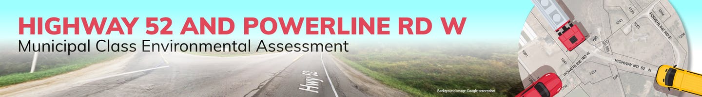
Highway 52 & Powerline Rd W Intersection Improvements EA
Share Highway 52 & Powerline Rd W Intersection Improvements EA on FacebookShare Highway 52 & Powerline Rd W Intersection Improvements EA on X (formerly Twitter)Share Highway 52 & Powerline Rd W Intersection Improvements EA on LinkedinEmail Highway 52 & Powerline Rd W Intersection Improvements EA link
The City of Hamilton has initiated a Municipal Class Environmental Assessment (EA) process to develop and assess alternative solutions to address traffic safety and related concerns raised by the local community both at and immediately adjacent to, the intersection of Highway 52 and Powerline Road West.
The intersection of Highway 52 and Powerline Road West is situated in a rural area, east of the Copetown neighborhood and approximately 3 km north of the Provincial Highway 403 interchange. Highway 52 is a north-south arterial road that traverses rural lands in the western portion of the City of Hamilton. It is a designated truck route with a posted speed limit of 70 km/hr. Powerline Road West is a connecting East-West rural arterial road with a posted speed limit of 60 km/hr. Due to topography and the presence of other physical features, Powerline Road East is offset and intersects with Highway 52 approximately 440 m to the South of Powerline Road West. On the East side of Highway 52 (immediately opposite Powerline Road West), a parking lot entrance exists. This lot serves users of an inter-city hiking and biking corridor known as the Hamilton to Brantford Rail Trail. The actual rail trail crosses Highway 52 approximately 100 m to the South of the intersection.
In addition to physical constraints, there are environmental, ecological and heritage considerations associated with this location. The subject location is also impacted by Provincial designations under the Greenbelt Plan, Niagara Escarpment Plan, and regulations of the Conservation Authority.
Concerns with traffic speed on Highway 52 date back to the early 2000’s and in 2008 a Municipal Class Environmental Assessment was conducted that made recommendations for implementing a roundabout at Jerseyville Road. More recently, in early 2022, residents approached the City to voice ongoing operational and safety concerns. In July of 2022, Public Works Committee directed staff to include funds in the draft 2023 budget to complete a Municipal Class Environmental Assessment to fully investigate the feasibility of implementing a roundabout for Highway 52 and Powerline Road West.
Public consultation is important in this study. The City of Hamilton is hosting the first of two Public Information Centres (PICs) for this study. The purpose of the first PIC will be to gather input and feedback from the local community at the onset of the project. A second PIC will be held at a later date to review the Study’s alternative solutions and the associated evaluation process.
Share Public Review Period on FacebookShare Public Review Period on X (formerly Twitter)Share Public Review Period on LinkedinEmail Public Review Period link
The Class EA Environmental Study Report documenting the planning process undertaken is available for public and agency review for a 30-day calendar period until July 10, 2026.
The Class EA Environmental Study Report documenting the planning process undertaken is available for public and agency review for a 30-day calendar period until July 10, 2026.
Share Public Information Centre #2 on FacebookShare Public Information Centre #2 on X (formerly Twitter)Share Public Information Centre #2 on LinkedinEmail Public Information Centre #2 link
CLOSED: This discussion has concluded.
The City held the second and final Public Information Centre (PIC) on October 21, 2025 to present the alternative designs and the associated evaluation process.
The City held the second and final Public Information Centre (PIC) on October 21, 2025 to present the alternative designs and the associated evaluation process.
Share Public Consultation Centre #1 on FacebookShare Public Consultation Centre #1 on X (formerly Twitter)Share Public Consultation Centre #1 on LinkedinEmail Public Consultation Centre #1 link
CLOSED: This discussion has concluded.
The City held a drop-in style open house on April 8, 2025 with a brief presentation to start, followed by display materials and staff available to answer questions and receive feedback.
The City held a drop-in style open house on April 8, 2025 with a brief presentation to start, followed by display materials and staff available to answer questions and receive feedback.
Aware that a decision or recommendation has been made
This section is empty
Background Review & Problem Identification
Highway 52 & Powerline Rd W Intersection Improvements EA has finished this stage
Review materials and investigate problems/gaps in the study corridor to identify key problems and opportunities. Identify Preferred Alternative. (January to April 2025)
Public Consultation - Round 1
Highway 52 & Powerline Rd W Intersection Improvements EA has finished this stage
Alternative solutions will be presented for review and feedback. (April 2025)
Develop & Evaluate Alternative Design Options
Highway 52 & Powerline Rd W Intersection Improvements EA has finished this stage
Develop and evaluate design options for the Preferred Alternative. Identify Preferred Design option. (May - July 2025)
Public Consultation - Round 2
Highway 52 & Powerline Rd W Intersection Improvements EA has finished this stage
Design options will be presented for review and feedback. (Q3 2025)
Preparation of Final Report
Highway 52 & Powerline Rd W Intersection Improvements EA has finished this stage
Final Environmental Study Report (ESR) will be prepared for the Public Works Committee and Council. (Q4 2025 - Q1 2026)
Notice of Completion
Highway 52 & Powerline Rd W Intersection Improvements EA is currently at this stage
Upon approval, a Notice of Completion of the final Environmental Study Report will be prepared & available for 30-day public review. (April 2026)