
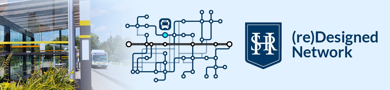
HSR (re)Designed Network
 The Hamilton Street Railway (HSR) is the provider of conventional and specialized transit services for the City of Hamilton. HSR has proudly delivered reliable and affordable transit for nearly 150 years, helping residents travel to school and work, get their groceries, go to medical appointments, and visit family and friends. As Hamilton continues to grow and change, it’s important that our network does so too to ensure it meets Hamilton’s present and future transit needs.
In 2019, the City of Hamilton’s Transit Division launched the (Re)envision the HSR project to modernize our network and transform the customer experience. The feedback we received from nearly 13,000 interactions with customers, residents, and stakeholders helped shape the design of the concept network.
To take the next step forward, we want to hear from you. Tell us what you think about the conceptual design by completing our short survey or attending a community event. Your feedback will guide any adjustments to the network before it’s presented to Council in early 2024.
The Hamilton Street Railway (HSR) is the provider of conventional and specialized transit services for the City of Hamilton. HSR has proudly delivered reliable and affordable transit for nearly 150 years, helping residents travel to school and work, get their groceries, go to medical appointments, and visit family and friends. As Hamilton continues to grow and change, it’s important that our network does so too to ensure it meets Hamilton’s present and future transit needs.
In 2019, the City of Hamilton’s Transit Division launched the (Re)envision the HSR project to modernize our network and transform the customer experience. The feedback we received from nearly 13,000 interactions with customers, residents, and stakeholders helped shape the design of the concept network.
To take the next step forward, we want to hear from you. Tell us what you think about the conceptual design by completing our short survey or attending a community event. Your feedback will guide any adjustments to the network before it’s presented to Council in early 2024.
Thank you to all participants who took time to ask valuable questions.
-
Share I am currently taking the 21 bus directly from upper Ottawa and fennel to heritage green. I am concerned that there will no longer be a direct line going that way and that's my easy and safe way to and from work, especially late in the evening. If a transfer to another rpute is needed, will thw wait times be better than they are now? on Facebook Share I am currently taking the 21 bus directly from upper Ottawa and fennel to heritage green. I am concerned that there will no longer be a direct line going that way and that's my easy and safe way to and from work, especially late in the evening. If a transfer to another rpute is needed, will thw wait times be better than they are now? on X (formerly Twitter) Share I am currently taking the 21 bus directly from upper Ottawa and fennel to heritage green. I am concerned that there will no longer be a direct line going that way and that's my easy and safe way to and from work, especially late in the evening. If a transfer to another rpute is needed, will thw wait times be better than they are now? on Linkedin Email I am currently taking the 21 bus directly from upper Ottawa and fennel to heritage green. I am concerned that there will no longer be a direct line going that way and that's my easy and safe way to and from work, especially late in the evening. If a transfer to another rpute is needed, will thw wait times be better than they are now? link
I am currently taking the 21 bus directly from upper Ottawa and fennel to heritage green. I am concerned that there will no longer be a direct line going that way and that's my easy and safe way to and from work, especially late in the evening. If a transfer to another rpute is needed, will thw wait times be better than they are now?
Lex asked almost 3 years agoThank you for your feedback on the draft (Re)envision transit network.
While it is correct that there will no longer be a direct route between Upper Ottawa & Fennell to Heritage Greene, you will be able to take either the rapid Route 60 L Line (every 10 minutes during peak periods, 15 minutes during the rest of the day), or 22 Upper Ottawa (15 min peak, 20 mins rest of the day) from Upper Ottawa & Fennell to Upper Ottawa & Mohawk. At that intersection, you will be able to transfer to either the 50 T Line (10 min peak, 15 min rest of the day) or 34 Mohawk (20 min all day) to reach Heritage Greene.
With high frequencies on both corridors, the transfer time at Upper Ottawa & Mohawk should be under 10 minutes at any point during the day. While we have not begun detailed scheduling for this network, Upper Ottawa & Mohawk is an intersection at which we would likely look to have timed transfers, particularly as it is the intersection of two rapid routes. In this instance, wait times should be under 5 minutes at most times of the day.
-
Share Charlton stop put it back the way it was. on Facebook Share Charlton stop put it back the way it was. on X (formerly Twitter) Share Charlton stop put it back the way it was. on Linkedin Email Charlton stop put it back the way it was. link
Charlton stop put it back the way it was.
Jocelyne asked almost 3 years agoThank you for your feedback regarding the recent changes made to the southbound stops on James St. As part of our gradual implementation of the (Re)envision transit network, stops along James St were shifted in order to improve the stop spacing and efficiency of buses that use that corridor. By shifting or removing stops, all stops along the corridor are now able to accommodate two buses loading and unloading at the same time. This in turn lowers travel times for customers. The old Charlton stop location and several operational issues, and due to the driveway within the stop area was limited to one bus loading and unloading at a time.
Additional customer amenities such as shelters and benches should be installed at the new Charlton stop location shortly, and we apologize for the delay in having those amenities relocated.
-
Share With Hamilton's Vacant Unit Tax rolling out and housing crisis, why isn't the transit plan focusing on helping people move from residential areas to get to their school, work and healthcare needs? e.g. the new homes near the lake communities along North Service Roads are nice but lots of people move out because people can't even get to Mohawk college or to Eastgate Mall or Eastgate mall by bus and there are no bike lanes etc so not possible to bike over! The Arvin line should loop back to stop at each of the neighbourhoods along North Service Road so people can go to work and school. Right now, lots of affordable homes there are left vacant or people are selling because in the long run transit in the area doesn't support a family and gas prices are high. on Facebook Share With Hamilton's Vacant Unit Tax rolling out and housing crisis, why isn't the transit plan focusing on helping people move from residential areas to get to their school, work and healthcare needs? e.g. the new homes near the lake communities along North Service Roads are nice but lots of people move out because people can't even get to Mohawk college or to Eastgate Mall or Eastgate mall by bus and there are no bike lanes etc so not possible to bike over! The Arvin line should loop back to stop at each of the neighbourhoods along North Service Road so people can go to work and school. Right now, lots of affordable homes there are left vacant or people are selling because in the long run transit in the area doesn't support a family and gas prices are high. on X (formerly Twitter) Share With Hamilton's Vacant Unit Tax rolling out and housing crisis, why isn't the transit plan focusing on helping people move from residential areas to get to their school, work and healthcare needs? e.g. the new homes near the lake communities along North Service Roads are nice but lots of people move out because people can't even get to Mohawk college or to Eastgate Mall or Eastgate mall by bus and there are no bike lanes etc so not possible to bike over! The Arvin line should loop back to stop at each of the neighbourhoods along North Service Road so people can go to work and school. Right now, lots of affordable homes there are left vacant or people are selling because in the long run transit in the area doesn't support a family and gas prices are high. on Linkedin Email With Hamilton's Vacant Unit Tax rolling out and housing crisis, why isn't the transit plan focusing on helping people move from residential areas to get to their school, work and healthcare needs? e.g. the new homes near the lake communities along North Service Roads are nice but lots of people move out because people can't even get to Mohawk college or to Eastgate Mall or Eastgate mall by bus and there are no bike lanes etc so not possible to bike over! The Arvin line should loop back to stop at each of the neighbourhoods along North Service Road so people can go to work and school. Right now, lots of affordable homes there are left vacant or people are selling because in the long run transit in the area doesn't support a family and gas prices are high. link
With Hamilton's Vacant Unit Tax rolling out and housing crisis, why isn't the transit plan focusing on helping people move from residential areas to get to their school, work and healthcare needs? e.g. the new homes near the lake communities along North Service Roads are nice but lots of people move out because people can't even get to Mohawk college or to Eastgate Mall or Eastgate mall by bus and there are no bike lanes etc so not possible to bike over! The Arvin line should loop back to stop at each of the neighbourhoods along North Service Road so people can go to work and school. Right now, lots of affordable homes there are left vacant or people are selling because in the long run transit in the area doesn't support a family and gas prices are high.
A City that Makes Sense asked almost 3 years agoThank you for your feedback on the draft (Re)envision transit network. In Version 1 of this plan (the version currently out for Public Consultation) we had proposed that the communities north of the QEW in Stoney Creek be serviced by our myRide on-demand transit service, similar to what is currently operating in Waterdown.
After consultation with the community, Version 2 of the plan will include Route 13 Lake running north of the QEW to service the Frances Rd community, from Grays Rd to Green Rd. This routing option will provide a direct connection between this community, Confederation GO, Centennial Walmart, and Eastgate Square. In addition, myRide on-demand transit will continue to be an option for trips to some other areas of Stoney Creek.
-
Share Why are you removing the Number 6 Aberdeen and this is really needed in it's current area? on Facebook Share Why are you removing the Number 6 Aberdeen and this is really needed in it's current area? on X (formerly Twitter) Share Why are you removing the Number 6 Aberdeen and this is really needed in it's current area? on Linkedin Email Why are you removing the Number 6 Aberdeen and this is really needed in it's current area? link
Why are you removing the Number 6 Aberdeen and this is really needed in it's current area?
EmJae asked almost 3 years agoAs part of the draft (Re)envision plan, modifications were made to service within the Durand neighbourhood. With northbound Mountain buses running in both directions along James St at very high combined frequencies, that corridor provides an easily accessible north-south option for residents. In addition, the Route 32 Fennell will run east-west along the Herkimer/Charlton one-way pair through the neighbourhood. The 8 Central will also provide northbound service along Bay St. We thank you for your feedback.
-
Share As a disabled person who lives in a Senior rich area, I'd like to know how you came to the decision to remove the only bus that takes me directly to work, or directly downtown? The proposal is to make me and the seniors from the 3 bldgs in the direct area to walk 2 plus blocks to the closest bus and for me at least, to transfer to another bus/LRT (not wanted) and then walk another 2 blocks down a steep hill. This will be extremely hard in the winter months. For the seniors who have a hard time getting out, they already lost the bank, grocery and post office and now have to go downtown to access them. Having the stops so far away limits what they can do and how much they can carry. Who makes these decisions? Has anyone checked on the demographics for the area before these ideas are implemented? Right now, for myself and the seniors of my area, they have 1/2 block to access the bus to go to and from the downtown area. Neither myself or any of the people of my area where able to attend any of they mtgs they held to discuss these proposterous changes you intend to make for our bus route. Any chance I can pls hear back from someone? on Facebook Share As a disabled person who lives in a Senior rich area, I'd like to know how you came to the decision to remove the only bus that takes me directly to work, or directly downtown? The proposal is to make me and the seniors from the 3 bldgs in the direct area to walk 2 plus blocks to the closest bus and for me at least, to transfer to another bus/LRT (not wanted) and then walk another 2 blocks down a steep hill. This will be extremely hard in the winter months. For the seniors who have a hard time getting out, they already lost the bank, grocery and post office and now have to go downtown to access them. Having the stops so far away limits what they can do and how much they can carry. Who makes these decisions? Has anyone checked on the demographics for the area before these ideas are implemented? Right now, for myself and the seniors of my area, they have 1/2 block to access the bus to go to and from the downtown area. Neither myself or any of the people of my area where able to attend any of they mtgs they held to discuss these proposterous changes you intend to make for our bus route. Any chance I can pls hear back from someone? on X (formerly Twitter) Share As a disabled person who lives in a Senior rich area, I'd like to know how you came to the decision to remove the only bus that takes me directly to work, or directly downtown? The proposal is to make me and the seniors from the 3 bldgs in the direct area to walk 2 plus blocks to the closest bus and for me at least, to transfer to another bus/LRT (not wanted) and then walk another 2 blocks down a steep hill. This will be extremely hard in the winter months. For the seniors who have a hard time getting out, they already lost the bank, grocery and post office and now have to go downtown to access them. Having the stops so far away limits what they can do and how much they can carry. Who makes these decisions? Has anyone checked on the demographics for the area before these ideas are implemented? Right now, for myself and the seniors of my area, they have 1/2 block to access the bus to go to and from the downtown area. Neither myself or any of the people of my area where able to attend any of they mtgs they held to discuss these proposterous changes you intend to make for our bus route. Any chance I can pls hear back from someone? on Linkedin Email As a disabled person who lives in a Senior rich area, I'd like to know how you came to the decision to remove the only bus that takes me directly to work, or directly downtown? The proposal is to make me and the seniors from the 3 bldgs in the direct area to walk 2 plus blocks to the closest bus and for me at least, to transfer to another bus/LRT (not wanted) and then walk another 2 blocks down a steep hill. This will be extremely hard in the winter months. For the seniors who have a hard time getting out, they already lost the bank, grocery and post office and now have to go downtown to access them. Having the stops so far away limits what they can do and how much they can carry. Who makes these decisions? Has anyone checked on the demographics for the area before these ideas are implemented? Right now, for myself and the seniors of my area, they have 1/2 block to access the bus to go to and from the downtown area. Neither myself or any of the people of my area where able to attend any of they mtgs they held to discuss these proposterous changes you intend to make for our bus route. Any chance I can pls hear back from someone? link
As a disabled person who lives in a Senior rich area, I'd like to know how you came to the decision to remove the only bus that takes me directly to work, or directly downtown? The proposal is to make me and the seniors from the 3 bldgs in the direct area to walk 2 plus blocks to the closest bus and for me at least, to transfer to another bus/LRT (not wanted) and then walk another 2 blocks down a steep hill. This will be extremely hard in the winter months. For the seniors who have a hard time getting out, they already lost the bank, grocery and post office and now have to go downtown to access them. Having the stops so far away limits what they can do and how much they can carry. Who makes these decisions? Has anyone checked on the demographics for the area before these ideas are implemented? Right now, for myself and the seniors of my area, they have 1/2 block to access the bus to go to and from the downtown area. Neither myself or any of the people of my area where able to attend any of they mtgs they held to discuss these proposterous changes you intend to make for our bus route. Any chance I can pls hear back from someone?
EmJae asked almost 3 years agoThrough our public consultation we have received feedback regarding the Route 51 University, and we will be making modifications to the route in Version 2 of our network redesign plan. These changes include an extension of the one-way loop through Downtown Dundas westward to Market St, and a straightening of the route along Main St W so it no longer detours through the Whitney/Emerson neighbourhood. This brings the alignment of the 51 University closer to that of the current 5B Delaware, with the addition of the Downtown Dundas loop for enhanced connectivity between the Governors Rd area and Downtown Dundas. We thank you for your feedback.
-
Share Why is there decreased transit access in Dundas (an already under-serviced area in terms of HSR routes)? on Facebook Share Why is there decreased transit access in Dundas (an already under-serviced area in terms of HSR routes)? on X (formerly Twitter) Share Why is there decreased transit access in Dundas (an already under-serviced area in terms of HSR routes)? on Linkedin Email Why is there decreased transit access in Dundas (an already under-serviced area in terms of HSR routes)? link
Why is there decreased transit access in Dundas (an already under-serviced area in terms of HSR routes)?
Dundas resident asked almost 3 years agoThrough the draft (Re)envision, transit coverage in Dundas has been significantly improved. In addition to the new Route 50 T Line, which will provide a direct rapid connection between Dundas and the Meadowlands, CF Lime Ridge, and Heritage Greene, enhanced local service will be provided within Dundas by our myRide on-demand transit service. All of these services will operate between 5 AM and 2 AM on Weekdays and Saturdays, and 6 AM and 1 AM on Sundays, which is a significant improvement from the current service levels on the 52A Dundas Local. The modified Route 51 University will continue to provide a direct link between Dundas and Downtown Hamilton.
-
Share Why would you put a bus transfer location at the main access corner in Dundas - where our community events are centered - Christmas Tree, Cactus Festival.... on Facebook Share Why would you put a bus transfer location at the main access corner in Dundas - where our community events are centered - Christmas Tree, Cactus Festival.... on X (formerly Twitter) Share Why would you put a bus transfer location at the main access corner in Dundas - where our community events are centered - Christmas Tree, Cactus Festival.... on Linkedin Email Why would you put a bus transfer location at the main access corner in Dundas - where our community events are centered - Christmas Tree, Cactus Festival.... link
Why would you put a bus transfer location at the main access corner in Dundas - where our community events are centered - Christmas Tree, Cactus Festival....
CJP asked almost 3 years agoVersion 1 of the draft (Re)envision proposed a transit hub for Downtown Dundas, tentatively positioned on Memorial Square. The exact location and configuration of this transit hub will be subject to extensive community consultation, which is still in its early stages. No final decision has been made at this point, nor will it be made without substantive community input beforehand.
-
Share What will happen to Memorial Square in Dundas? So many people sit there. Thousands in our town gather there for the tree lighting. How big will your building be there? on Facebook Share What will happen to Memorial Square in Dundas? So many people sit there. Thousands in our town gather there for the tree lighting. How big will your building be there? on X (formerly Twitter) Share What will happen to Memorial Square in Dundas? So many people sit there. Thousands in our town gather there for the tree lighting. How big will your building be there? on Linkedin Email What will happen to Memorial Square in Dundas? So many people sit there. Thousands in our town gather there for the tree lighting. How big will your building be there? link
What will happen to Memorial Square in Dundas? So many people sit there. Thousands in our town gather there for the tree lighting. How big will your building be there?
Theresa Horrill asked almost 3 years agoVersion 1 of the draft (Re)envision proposed a transit hub for Downtown Dundas, tentatively positioned on Memorial Square. The exact location and configuration of this transit hub will be subject to extensive community consultation, which is still in its early stages. No final decision has been made at this point, nor will it be made without substantive community input beforehand.
-
Share Will this system be easy to use for everyonr on Facebook Share Will this system be easy to use for everyonr on X (formerly Twitter) Share Will this system be easy to use for everyonr on Linkedin Email Will this system be easy to use for everyonr link
Will this system be easy to use for everyonr
Cute14 asked almost 3 years agoWe encourage you to complete the survey and give us your feedback - the proposed new network will have hierarchical route structure, easier-to-understand route numbering convention (fewer As and Bs), and standard frequencies and service hours across all route types.
-
Share Is there any plan for transit, connecting BINBROOK with Centennial GO centre? on Facebook Share Is there any plan for transit, connecting BINBROOK with Centennial GO centre? on X (formerly Twitter) Share Is there any plan for transit, connecting BINBROOK with Centennial GO centre? on Linkedin Email Is there any plan for transit, connecting BINBROOK with Centennial GO centre? link
Is there any plan for transit, connecting BINBROOK with Centennial GO centre?
Nidhi Pranav asked almost 3 years agoWe are currently gauging community support and evaluating potential service options. Further updates will be provided when the revised (Re)envision transit network goes to Council for approval next year.
Who's Listening
-
HM
Key Dates
-
September 15 2025
-
April 17 → September 30 2023
-
May 11 2023
Project Timelines
-
Survey and Ask a Question Open for submissions
HSR (re)Designed Network has finished this stageThe project consultation is open for contributions to the survey and to ask a question.
-
Survey Submissions Reviewed
HSR (re)Designed Network has finished this stageSurvey is closed for evaluation and review. The project team will report back on key outcomes.
-
HSR Next: Moving Hamilton Forward Presented to Council
HSR (re)Designed Network has finished this stageInformed by survey results and community feedback, an updated growth and phasing strategy "HSR Next: Moving Hamilton Forward" was presented to Council on September 15 and approved on September 17, 2025.
-
Engagement concluded and Implementation Planned
HSR (re)Designed Network is currently at this stageImplementation of approved plan scheduled for 2027.
FAQs
- How much will this cost to build and operate?
- When would the new network go live?
- When will LRT begin operating?
- I’m not a transit user. How does this impact me?
- How were transit hubs identified?
- How does the proposed network support the LRT?
- Will connections to other neighbouring transit services be maintained or added?
- What amenities will be available at transit hubs?
- Will transit priority measures slow down traffic and create congestion?
- How will my commute be impacted during implementation?

Thank you for your contribution!
Help us reach out to more people in the community
Share this with family and friends